Trailforks at Rocky Point
Maps of the Rocky Point trail system have been compiled and uploaded to Trailforks as hidden trails. To be able to view these hidden trails, one must be added to the NWTA Rocky Point group on Trailforks. This depends on: 1. Current membership, 2. Rocky Point waiver signed, 3. matching name and email addresses in 1 and 2.
How do I SEE THE MAPS?
- NWTA membership is current, and member is in good standing (click here to join).
- Member has signed the online release of liability waiver (click here to sign).
- Fill in your Trailforks username in your membership form on your NWTA account. Log in; click the green “Edit Profile” button; then click the green “Next” button. Enter the appropriate information. Note: This process does not create an account for you. You must have already created an account at trailforks.com.
- Wait for the information in the form to be cross checked with the databases for membership and liability waiver. If it has been significantly longer, please contact [email protected] to follow-up.
- The cross-checked list is sent to the NWTA Trailforks coordinator for your username to be added to the NWTA Rocky Point group. An email notification will be sent once your user has been added.
Think you should have access, but not seeing any trails? Try the following:
Note: The technology is fickle and not as smart as us humans, so please be sure to follow the steps exactly. The trails will appear as dashed lines when you have access. If only a couple trails or no trails are visible, continue with the following:
- If you haven’t areceived a confirmation email from “[email protected]” saying “You’ve been added”, check the following:
- You may have received an email indicating you have an invalid username. Make sure you have input into your NWTA account the username you signed up for on www.trailforks.com.
- There may be a name mismatch between your NWTA account and waiver. A computer is being used to do the cross referencing. It will only recognize exact matches and isn’t smart enough to correlate nicknames (e.g., Dave and David). Please fill out a waiver with a name that matches the one on your account.
- Ensure your membership is current.
- Note: It may take up to an hour after sign up to send the email, and the system only runs from 8:00 a.m. to 10:00 p.m. Sometimes the system will go down. If you think something is wrong, feel free to email us at [email protected].
- You’ve gotten the confirmation email, but have never been able to see trails in the app:
- Check to see if you can see trails on the Trailforks website, if yes, it’s an app configuration issue. If not, it’s an account issue.
- App configuration issues:
- Make sure you’re signed in with your Trailforks user account
- Re-add the Oregon region (initially required for all users)
- Navigate to Settings then Downloaded Regions
- Swiftly swipe left on Oregon in order to properly remove the region (clicking on the region and selecting delete will not work)
- Select the plus button and re-add Oregon
- Set your local region on the free version of the app (not required for pro) (see section below)
- Restart your phone. Sometimes the new map data doesn’t populate without a restart
- If that still doesn’t work. delete the app, reinstall, log in, add the Oregon region, and restart your phone
- Account configuration issues:
- Make sure you’re signed in with your Trailforks user account
- otherwise contact us at [email protected] for help
- You used to be able to see the maps on the app, but now cannot:
- Retry all the steps from the above “App configuration issues” in order even if you’ve done them before. There have been issues with this happening after signing up for pro and sometimes the data just gets corrupted. This will fix it.
Please do not contact Trailforks (they cannot help you with this process). Contact [email protected] – we’re happy to help.
View trails on the app without Trailforks Pro
Trailforks’s free version is limited, but still works for your local trails. The app will try to automatically set your home region. This is a 38 mile by 38 mile square.
What else should I know about using the Rocky Point hidden trails?
- This only works on web browsers, and the iOS and Android apps. It will not work on Garmin devices and other platforms.
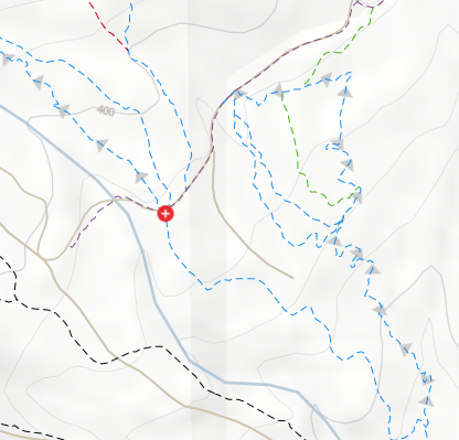
- The trails will show up as “hidden” with dotted lines instead of the normal solid lines you are used to seeing and without trail names over the lines (see below)
- The trail system map is constantly being updated to reflect all of the new trail work being done. These Trailforks updates will be reflected immediately on the computer interface, but may require you to re-download the region to see the updates on the mobile interface.