Active forestry operations will be in effect Monday to Friday ALL HOURS, from June 4th until further notice.
Active logging means we only get to ride Rocky Point trails at Weyerhaeuser’s discretion, which is to say that restriction and closure notices are important for continued access. We have spoken directly to the loggers and the truckers. They know we are out there, they like what we bring to the forest, and they need some space to keep you safe. Please don’t second guess the posted signs. It’s all about minimizing risks.
Translation: Stay off gravel roads at Rocky Point Southside beyond Tres Amigos, adhere to posted closures, be careful and yield at trail/road crossings.
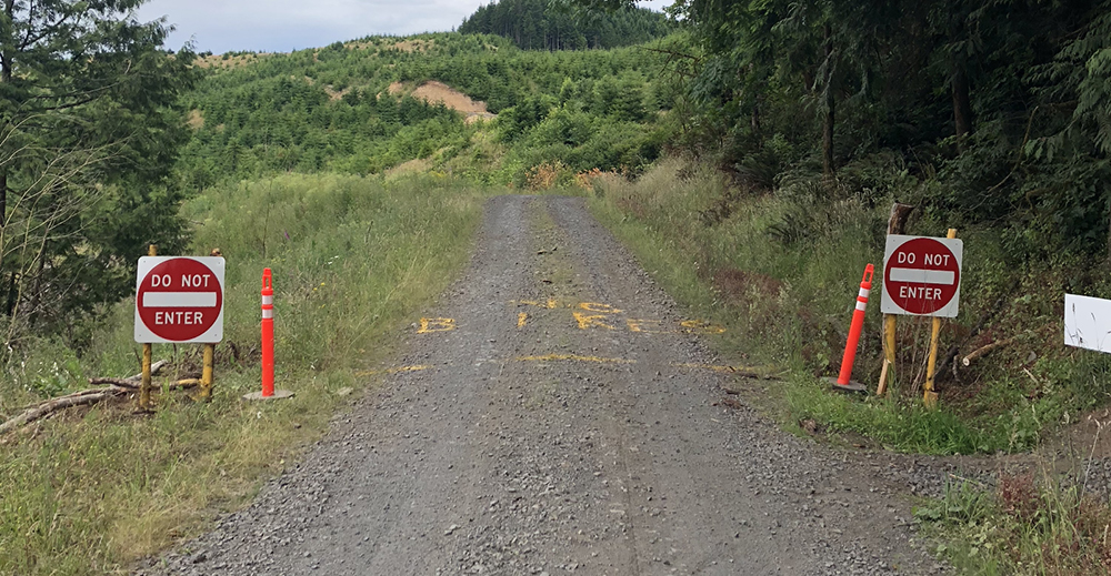
*** If you see signs like this, don’t go there ***
Specifics: Restricted travel beyond the blue gate. Bikers should proceed from the parking lot to the entrance of Tres Amigos with a keen awareness of potential truck traffic. Bikers should only access South trails by climbing up Tres Amigos and using the Pipeline crossing to get to Switchblade and DH trails. Always listen for trucks approaching, cross the roads with caution, and always yield. Under no circumstances should bikers access the area South of Pipeline Crossing during this closure. Please adhere to all closure notices posted.
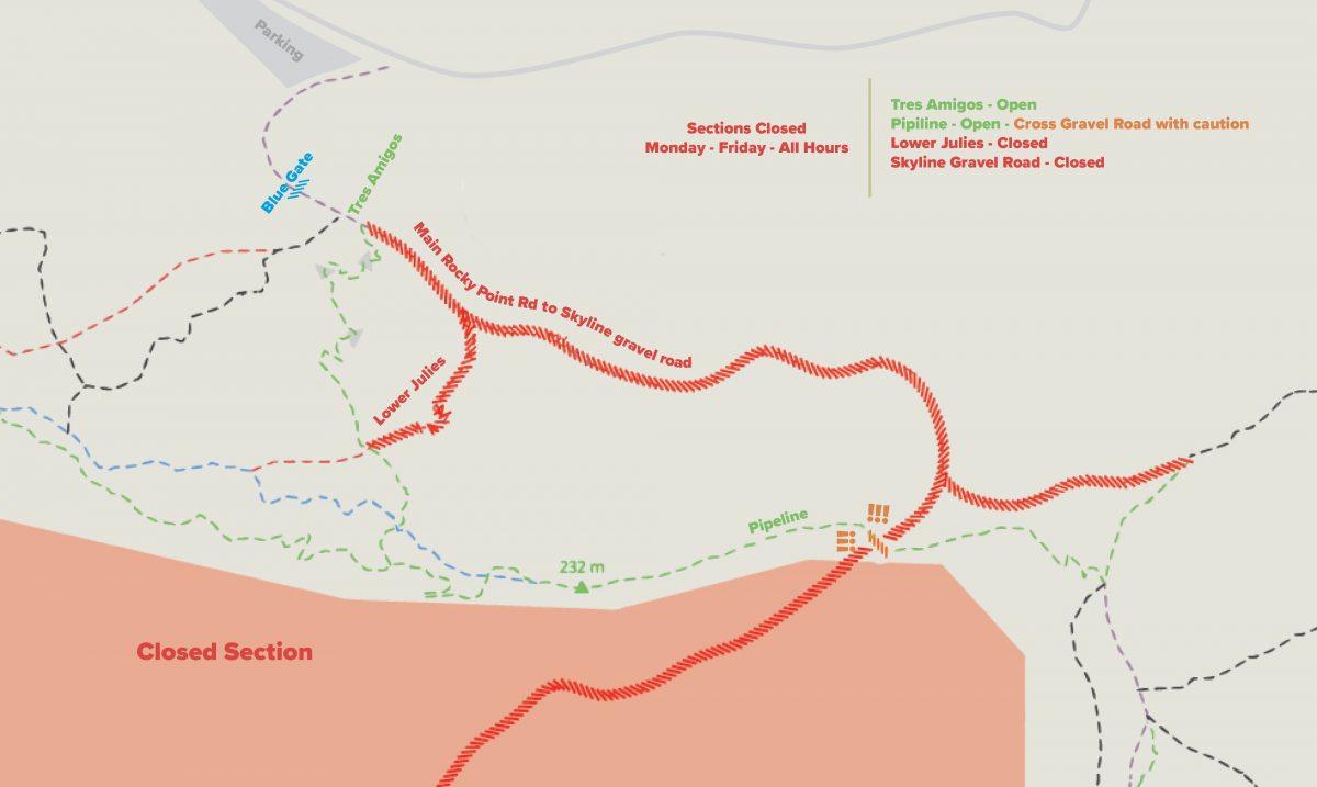
Minimize exposure. Only cross roads at trail intersections, be vigilant of sight-lines, and do not ride on roads other than to access Tres Amigos from parking.
Stop, look, and listen. Come to a complete stop before crossing roads to verify there are no trucks driving toward you.
Get out of the way. If you see a truck heading toward you immediately dismount your bike and get off the road. Wait till the truck has passed before getting back on the road and riding. The trucks have the right-of-way!
Obey signs. This is an active logging area. Access to certain trails, roads, and parking areas can change weekly, daily, and even hourly. Stop and read signs to ensure access or parking allowed. Trucks need extra turning space. If you are parked in a way that blocks access to a road or gate they need to use, they will not hesitate to have your vehicle towed.
Thank you,
Rocky Point Stewardship Team